Wednesday May 21
Our
last post had us at Tjukayirla Roadhouse on the Great Central Road, some 300km
from Laverton, but with few details of our journey there because finalising the
post there hadn’t been part of the plan!
We
left Laverton in the rain last Friday, but happily it had largely stopped by the
time we reached The Pines parking bay, 120 km east. The road had been
corrugated in spots for the first 84km to Cosmo Newberry, but after that it was
pretty good most of the time and often very good for an unsealed road and the
rain at least meant that there was no dust!
 |
A raindrop-spattered view of the Black Oaks (Casuarina pauper) at The Pines -
not really pines at all! |
 After
leaving The Pines we had some sunshine, which was most enjoyable and also dried the
car so we could stop and duct tape the expensive cardboard anti-stone barrier to the back
windscreen and let some air out of the tyres to lessen the chance of punctures
from sharp rocks. Not that there were large rocks on the road – the gravel was
quite small and benign.
 |
| Marble Gums and spinifex |
We
were already in the Great Victoria Desert and were yet again surprised by the amount of
vegetation - mulga, spinifex, Marble
Gums and the odd Desert Kurrajong. In areas which had been burnt, Native
Poplars, lovely slender trees with light green leaves and white trunks were in
abundance.
 |
| Native Poplar (Codonocarpus cotinifolius) |
As
we came closer to Tjukayirla, the rain started again – not a great surprise as
the clouds ahead had been looking threatening for a while. We were now into country
with sand dunes with only Black Oaks growing on them and they looked terrific.
 As
the rain was making things quite dark and time was getting on, we decided to
spend the night at the Tjukayirla campground and it was quite an exciting time
as Murray was able to light his first fire of our whole trip! He was so
thrilled he actually lit two fires – one in the fire pit and another in his
nifty little gas bottle ‘fireplace’ on which a plough disc makes a wonderful
barbeque plate!
 |
| The perfect place to enjoy a glass of wine! |
We
had a few spits of rain overnight and left on Saturday morning with the sky
still grey. Wasn’t long before we stopped to admire this beautiful big Desert Kurrajong.
These trees are well adapted for the desert – as dry conditions set in they gradually
loose leaves, stop setting fruit and seeds and the roots store water and were
an important water source for Aboriginal people.
 |
| The road ahead |
We
were not underway again for long before we were brought to a halt by a bull
camel and his harem of ten in the middle of the road. Apparently they often camp
on the road at night! Even though they are a very destructive feral pest, it
was quite exciting to see them.
 |
I hope that droopy lip of the bull camel on the right does not indicate he is
unhappy with his family! |
Sadly
the drizzle started again after lunch, which made it impossible to see and
appreciate the vastness of the landscape. We were able to enjoy the close up
things though, like this gnamma, or rock hole on the side of the road. These
holes in granite outcrops act like natural water tanks, holding water which is
replenished from stores in the underground rock. The small surface area
minimises evaporation, so they remain a vital source of water.
The
landscape changed quite dramatically as we got closer to the Warburton Roadhouse,
which is about half way between Laverton and Uluru and moved into the Gibson
Desert with its red sand dunes. I had been keen to visit the Tjulyuru Regional
Gallery which displays art work from surrounding communities, but discovered that it is only open Monday to Friday and as we
had kept moving along faster than we had expected because of the rain, our
timing was well out!
 |
| Approaching Warburton Roadhouse |
Nothing
for it but to keep going and as we left the community we were into the
Warburton Ranges, with their beautiful dark red rocks. The rain meant that the
light was not much good for photos, but I persisted nevertheless!
 |
| Towards the east! |
 |
| Warburton Ranges |
Travelled
another 90km to Yarla Kutjara campground, where we spent night all alone and laughed
about having seen only two cars and one motorbike on the road all day. The
persistent drizzle ruled out exploring the surrounding sand dunes, so we just
enjoyed hearing the dingos howling all around – this is such an evocative
sound.
 |
What is left of one of the tractors used to make the Great Central Road, parked
for eternity at Yarla Kutjara |
 |
| Another beautiful tree - Desert Bloodwood |
Despite
our fervent hopes for better weather, Sunday dawned as grey and cloudy as
Saturday had ended. We again saw a herd of camels on the road early on – more on-road
campers? We pressed on towards Warakurna Roadhouse and enjoyed dappled views of
the Rawlinson Ranges as we came closer. Topped up with fuel here, checked out
some Tjulyuru art work which was on display, offsetting some of my disappointment of yesterday and continued our trek east.
Passed
two graders which were towing all the gear they must need to camp out in these
remote areas whilst they take care of the roads – caravan, fuel tank, 4x4
vehicle. Looked pretty amazing.
 |
| The approaching 'grader-train' |
We
were now getting into even more interesting country and came
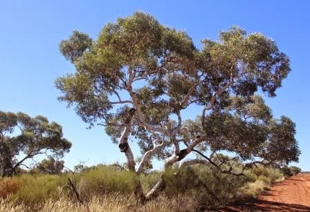
across our first grove of Desert Oaks (Allocasuarina decaisneana), which look stunning against the red
sand and spinifex.
 A
hunt for a suitable place to pull off the road for a coffee (these are few and
far between) ended very well indeed – quite coincidentally we stopped by a tall
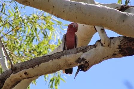
Ghost Gum, which turned out to be the one on which the Len Beadell Plaque, commemorating the 1960 construction of the Sandy Blight Junction Road by the Gunbarrel Road Construction Party, is located. Even more importantly though, it was hosting lots of superb green and yellow
budgies, some of which were checking out prospective nesting hollows. We were
thrilled – the first budgies of our trip and we could have a good look at them, as they are usually seen as a flash of yellow and green as the flock whirls
past.
 |
| Is this one any good? |
 |
| The nearby range |
We
were soon approaching the NT border and the surroundings were changing yet
again – ranges all around and it was hard not to make comparisons with the
Pentecost Range in the Kimberly.
 |
| Don't you just love these colours? |
 |
| How tough and adaptable Grass Trees must be |
As
soon as we crossed the border the road deteriorated significantly – it was
quickly evident that the NT government is not as interested as is the WA government
in maintaining this as an important tourist route. We stopped for lunch at
Kaltukatjara (Docker River) Campground, which was surrounded on all four sides
by stunning ranges.
 |
| More beautiful Desert Oaks |
Hopes
that the road might improve were soon dashed and we spent the ensuing 150km to
Kata Tjuta (The Olgas) cussing and jiggling as Murray picked his way through
the corrugations in a never-ending quest to find that
magic speed which is just right to deal with the problem without wrecking the
van. Stopped a couple of times to check inside said van, as visions of cupboards
crashing to the floor were hard to keep at bay!
 |
| Sadly this van did suffer a terrible fate! Hope those towing it were not hurt |
Happily no such disasters occurred – our faith in the quality of our Evernew caravan was
not even dented and we finally drove on to the sealed road at Kata Tjuta with a
great sense of relief and travelled the 50km to Yulara feeling like we were
driving on cotton wool!
 |
Views of Kata Tjuta confirmed the end of the corrugations was nigh!
|
 Set ourselves up in the campground and then spent a bit of time getting rid of the worst of the dust that had managed to infiltrate through fridge and battery vents. Still, it is small price to pay for being able to explore these interesting places and we are glad we decided to come back along the Great Central Road, but will probably not feel the need to do it again, even in really fine sunny weather! We thought that we would take longer to get to Uluru and that there would be more opportunities to stop and enjoy some walks, but it was more a 'road trip'.
We
have had a terrific three days here, enjoying Uluru, Kata Tjuta and the ‘resort’
itself. There has been a fair bit of cloud coming and going, which has not allowed
for the beautiful sunrises and sunsets everyone hopes for, but that is OK. As I
sit writing this tonight, there are intermittent showers, thunder and lightning
so tomorrow seems like the perfect time to continue our journey south. We plan
to be in Port Augusta by Saturday, so will put some photos of our time here on
the blog then.
.JPG)
+(4).JPG)

+(3).JPG)
+(9).JPG)
+(11).JPG)
+(2).JPG)
.JPG)


.JPG)
+(9).JPG)
+(11).JPG)
+(2).JPG)


